Wednesday, May 10, 2017

Out of the Comfort Zone: The Susquehannock Trail System Backpacking Trip - Day Four

(Part One, if you missed it. Part TwoPart Three, Part Four.)

Day four started out cold.  It had been the coldest over-night so far, with clear skies, though over night, a few drizzles moved in, and the morning was cloudy and cool.  We got going, knowing this was our shortest mileage day, and that we would be back home before the end of the day.

My left shin and ankle were still hurting pretty bad, but I set off strong, pushing myself first since I was the slowest on the hills.  I was also both eager to get out of the woods, and not really at all.  There is something basic in the immediacy of the outdoors. Do what you need when you need, then keep going.  Especially when other people depend on you.

I hiked alone quite a bit of the morning, enjoying the woods and sights and sounds.  I listened to a little bit of music, but it was making me too sad, so I stuck to the sound of streams and the wind and birdsong.

The stream flowing back towards camp.

More well marked signs.

We stopped for lunch along a creek with about 10 miles left to go in our hike. The spot was really nice, and we took a little more time than usual, knowing it was our last meal on the trail.  It was in a nice spot by a creek, and we knew we only had one more big climb before the end of our hike.  The temps were cooler and the wind was picking up, which made getting moving more appealing.

We passed through Patterson State Park, which was just a tiny campground, but they had toilets!  The trail became very easy and rolling, and we passed some beautiful areas.  I took a lot less pictures - I think mostly because we kept moving, and I was enjoying just being in the woods.

It's hard to describe that last few hours on the trail.   There was an excitement that we had finished the circuit of this trail, but also a sadness that we were done.  Happy that we would be in warm dry homes at the end of the day, but a little sad that soon we'd be glued to our phones and screens.  Wanting the comfort of a hot meal without sitting on the ground, but not missing the idea of crowds or traffic.

So we finished up in a drizzle, in the cold, and we waited so that we all could finish together.  And we did.  We cleaned up, drove into the nearest town together, had a nice dinner (with a lot of hot tea).  We got home very late, and I got a very long shower, and spread out all my stuff to dry, and fell asleep.

Rich at one of the last log boxes.

Almost done

Finished!

The brassard!  

Wooden map at the trailhead - we followed the yellow bit.

I learned a lot on this trip, about backpacking, about myself.  I had taken a little journal - I only wrote in it once.  I think I'd take it again though, especially on a trip with a little more down time.  I took soap to wash my clothes in - I wouldn't take that on a hike less than a week long, I think, I didn't use it.  I took pretty much the right amount of clothing, but I'd figure my feet out better before next time.  I think there's something to doubling up on socks.  I took just a little too much food, but only just.  Everything else I was pretty happy with.

I want to thank Rich and Alisha and Daren - they know I'm still new at this, and give me advice while still letting me figure out stuff for myself.  I wouldn't be where I am without them.  And they're great at giving you space for yourself on a hike, while still being there when you want company, and making sure you're eating and drinking when you need to.

I can't wait to get out there on the next trip!

Part One, if you missed it. Part TwoPart Three, Part Four.

Monday, May 8, 2017

Out of the Comfort Zone: The Susquehannock Trail System Backpacking Trip - Day Three

(Part One, if you missed it. Part TwoPart Three, Part Four.)

Now, before I get into day three, I've been painting this trip as realistically as I can, while skipping some of the more... trivial details.  Truth is, I was pretty comfortable on the trail.  Going to the bathroom isn't an issue, I've been peeing outside since I was little (I felt that it was unfair that boys could pee wherever they wanted, so as an outdoorsy kid, I remedied that injustice for myself pretty early), and as a trail runner... well, when you gotta go, you gotta go.

I was fine drinking (treated) creek water.  I was using a sawyer mini filter to filter my water right as I drank it, and I had a steri-pen that I was treating my water before cooking with it during meals.  Up until I couple of years ago, I was terrified that every time I was lighting my little folding stove, the fuel container was going to explode (I'm pretty comfortable with it now), and I've figured out what kind of foods work best for the trail (with some help from Rich and Alisha).

I'm not used to carrying weight.  My pack weighed around 33 pounds when I started out.  My back and shoulders actually did really well for the trip.  My feet were another story.  I was wearing running shoes, and by the end of the first day, I had a couple of pretty bad hot-spots, and starting out the second day was fairly painful to start, but once I started walking, the pain faded.  I tried taping / bandaging my feet, but the bandages ended up smooshing around in my wet socks and shoes, making the rubbing and blisters worse.

The third day, I wore sock liners and then toe socks, which seemed to do ok.  My feet felt pretty good.  I however, was developing some severe pain in my left shin, but I clenched my teeth, and moved forward.  There was no "DNF" in this hike.  So I hiked.  I had a couple near-tearful moments going downhill a few times, when my leg would feel particularly bad, but I took a couple deep breaths, looked at some flowers, and pushed on.  Day three and four were rough for me, pain wise, but I tried not to let it detract from my experience.  

I took ibuprofen, I used body glide, I had sun-block and chap-stick.  I brushed my teeth every morning and every night.  I put powder on my feet every night, and put cocoa butter on them every morning.  Besides the few things I've mentioned, I felt good, I slept pretty good each night, and I never felt like I was missing something or lacking anything, though I will do a better job choosing footwear and sock layering next time.

I want to say the third day of hiking was probably the best weather day, and a pretty good day in general.  The hiking was challenging, but not as difficult as day two, and we had settled into a routine.      
Grass and Pine area leaving camp on Wednesday morning.

Pine tunnel

The highlight of the day would be reaching the small village of Cross Forks, which had a store, bar, and maybe bathrooms!  We had hoped to reach it the day before, but had underestimated the distance, so we looked forward to an early Wednesday lunch.  As the day continued, we realized we were following Elk tracks along the trail.  We followed them all the way into Cross Forks.

Kinney's Country Store and Bar - sub sandwiches, Dr. Pepper, and Swedish Fish!

We came down into Cross Forks into a little bit of a rain shower.  We went into the store and bought sandwiches and drinks, and I replenished my Swedish Fish.  I wasn't very hungry, so I ate part of my sub and some chips, and knew I didn't want to be too stuffed for the next climb out of the valley.

The clouds broke as we left town, and the day became beautiful, crisp and sunny.

Leaving Cross Forks, over Kettle Creek
 There was a mile of road followed by a pretty challenging mile uphill.  I set off by myself for a little while, and felt pretty strong.  We all gathered at the top of the hill, and I popped on my ipod on and led the way along some of the nicest trail we had been on.  Flat and gradually down, we approached the Hammersly wild area, and a section where a remote "Pool" was.

The trail continued to be very well marked.

Mountain Laurel lined paths.  I bet this is amazing in mid-June.

Logging our visit in a sign in box.

Green woods...

...blue skies.

Lunch break at "The Pool"  A very remote portion of the trail.  Five miles of challenging hiking from the closest road.

Unfortunately, it was a little too cold to see how nice the swimming would be.

It was a good spot to fill up my water pack.

And to just enjoy the scenery for a little while.

 I think the thing that made me both happy and sad about the area around "The Pool" was it's remote location.  I thought how neat it would be to bring my son back there, and show him, and let him swim in the creek, but at nine years old, with how challenging the trail was in this part, I knew it might be a bit much for him.  It gives me something to look forward to doing with him, though...

Leaving the area of Hammersley Fork

We stopped for dinner at "Duff's Camp", or as it was so proclaimed on a small wooden sign, and then we continued on our way. We were all giggly and in good spirits after a very good day of hiking. Little did we know...

The trail after "Duff's Camp"

"Three days on the trail me."  I think this was right after I faceplanted in some (luckily soft) dirt.

We came to a railroad grade that went a long a wide valley, as twilight was just starting to fall.  We knew we had one more big hill before we came back to a campsite down along another creek. We found a sign in box in the valley, near some houses - the first real houses we'd seen that weren't in Cross Forks.  We started up the hill.  There was a gorgeous view, but it was a super steep up, and was long, and came into some very challenging side-trail down.

Rich signing us in.

Alisha ready to go!

The last view of the evening.  Beautiful old mountains.

The camp wasn't the best, but night was falling, we were exhausted, and the temps were dropping.  We set up fast, I layered all my clothes I had on, and curled into my sleeping bag.  I was a little sad.  It was the last night of vacation, and tomorrow we would finish up and return to the real world...

Part One, if you missed it. Part TwoPart Three, Part Four.

Sunday, May 7, 2017

Out of the Comfort Zone: The Susquehannock Trail System Backpacking Trip - Day Two

Part One, if you missed it. Part Two, Part Three, Part Four.

Day Two started out slow.  There's something about waking up outside, but in a tent, as the dark gets a little less dark, and maybe you here a chirp of bird-song, and you can start to see the side of the tent in front of you, and though you're not sure what time it is, you're awake, and you get moving.

We had breakfast, packed up camp, and headed out.  We were hoping to get some good miles in.  There had been no bear activity, that we could see, but there were a couple times in the middle of the night where the peepers suddenly were silent, and then after a few minutes, would resume, so something had wandered by.

Grassy doubletrack crossing the trail.

The day started out pretty easy, and after a couple of easy miles, we descended into Ole Bull State Park and campground.  We took a break to fix feet and have a snack, fill our water at an on site pump, and use real toilets!  Woo!  

Long down into Ole Bull State Park

The day was brightening.  Bridge over Kettle Creek.

Now I like maps.  I like having them on hiking trips, mostly because they can save your life and keep you from getting lost.  But I also don't like to look at them in too much detail.  I knew a big hill was coming, but I didn't know how big.  We climbed and climbed and climbed out of the park.  We kept each other going, and finally made it to the top.  This was the first in what would be a very challenging day.

The vista after the climb away from Ole Bull

The scenery was lovely, but was even better with a little bit of blue sky.

We came to a creepy part of the trail called Spook Hollow, where the sign said "Stay to the center of the trail, stay within the sight of companions, refrain from looking back, Do Not Try To Run"  The pines and spruces grow so close together in this section, that when the wind blows, they creak and groan.  It was a rather spooky section of the trail, and I'm glad it was daylight and the sun was bright at this point, or it would've been scarier.

The beginning of Spook Hollow

The trees were thick, making the woods dark, even in the sun.

There were some really amazing trees.

The day was long and difficult.  There were a few sections of old railroad grade, but then we came to the Doughnut Trail.  It was a super steep downhill grade, followed by a super steep uphill.  Followed by more steep down, and some rolling tough double track and gas line.  We were all spent.  We were incredibly lucky though, finding the campsite we had been shooting for was a shelter!  It made the long push at the end of the day worth it.

Old Railroad Grade.

Super steep Doughnut Hole Trail - following Alisha down

Looking back up.  Not sure if the camera really captures how steep these hills were.

 Bridge at the bottom of the hill, then heading back up.


There were a lot of creek crossings - the bridges were no more.  Ok, mostly it was us crossing the same creek multiple times

Looking behind from where we had come, going up the last hill before we hit the shelter.

Having the shelter made for a very cheerful evening, but we decided that we would get up earlier and get going quicker the next day, trying for as many miles as we could cover on Wednesday to make our last day as short as we could.  We were 42.5 miles in, roughly, pretty much halfway done, and it was our hardest day.

Shelter!

Part One, if you missed it. Part TwoPart Three, Part Four.

Saturday, May 6, 2017

Out of the Comfort Zone: The Susquehannock Trail System Backpacking Trip - Day One

(Part One, if you missed it. Part TwoPart Three, Part Four.)

I try to pass myself off as a pretty knowledgable outdoors-woman.  I can point at a plant or critter outside and identify it at least part of the time, I can eat certain things growing outside and know that I won't get sick or die, and I can stay out in the woods during the night while doing ultra-running feats with a headlamp and feel pretty darn invincible.

And though I don't consider myself easily spooked from a challenge, last week's adventure was something very new to me.  Now, last fall, I did a hiking trip with friends that was three days and two nights in the woods, and that was my first real 'backpacking" experience.  We did about 11 miles each of those days, on some challenging terrain.  But this was much different.

The Susquehannock Trail System is about 85 miles over some of the most remote trails in Pennsylvania.  One of the parks we hiked near, Cherry Springs, is known for having some of the best star-gazing in the east, because there is no light pollution.  You know why there is no light pollution?  Because there is no one living out there.  I didn't think much about this building up to the trip.  I had been looking forward to the hike-cation for months.  It's been a stressful year, and I was looking forward to just being out in nature.

Building up to the trip, the weather forecast was iffy, so I packed a bunch of crap.  I mean, I sorted through my gear very carefully and packed everything I might need, while being conscious of the weight of my pack.  Four days of 20+ miles of walking means the less weight the better.

Packed as efficiently as I get!

I had ordered a set of maps and the official trial guide last winter from the Susquehannock Trail Club's website.  I also had found a person who emailed me a GPX file of the trail for my garmin.  Now though it wasn't really necessary, he had a lot of interesting things and mileage marked, which really helped out later in the hike.

Maps!

My own map file turned out pretty good.  Though it counted my walking around campsites as mileage, so it estimates my mileage higher than that of the actual trail.  You can find the Garmin Adventure link here.  The trail book and maps are super helpful, and compact.  So, packed and at least less green than I was on the last hiking adventure, we set off.

The trailhead is a little over 3 hours away, so we left super early to get to the trailhead to meet the rest of our party.  It was about a half a mile hike to the first trail log-in book, and we signed and then followed the trail in a clockwise direction.  The 85 mile loop follows many different trails, but is very well blazed for most of the way, and fairly well maintained for being such a remote trail.  There were a few areas where we spent a few minutes finding the trail, or making our way through blowdowns, but most of the time, the orange blazes or orange STS written on trees or signs were easy to follow.


Cheerful and ready to start!

The trail started out very easy, not very wet, and rolled downhill with green grassy paths.  There were so many spring flowers on the trail, that keeping my head down and on my feet was a pleasure, seeing spring beauties, violets, trillium, may apples, and a super variety of others that kept my little nature brain occupied most of the hike.

Our first break at an overlook about a tenth of a mile off the trail.  


The vista looking towards Denton Hill State Park, about 2.5 miles in.

That first day was pretty easy hiking.  The weather was decent, there were few bugs, and I was pretty obsessed with the flowers and the scenery and my friends.  We leapfrogged, sometimes stuck close together, sometimes broke away from each other, sometimes chatted, sometimes just let nature's soundtrack be our background.

The trail was beautiful and green.

The downhills went along idyllic streams.


For the first 20 or so miles, mile markers were on some of the trees to tell us our progress.

The Bridge at Lyman run - Mile 7.


Some of the bridges were a little more primitive


Just an example of the beauty the forest offered, over and over.

Photo op!

Old Dynamite storage building.

Someone had left a hat.  Alisha contemplated adopting it, but we left it there.

The trail was signed really really well.

"Everybody Loses when Timber Burns"

The fire tower is no longer in use.

Red Trilliums, just a few of the wildflowers that were everywhere along the trail.

There were cabins and lodges dotted along the trail through the forest.

Snack and rest break along the trail.

There were a lot of Ramps along the trail in places, like this.


There were only two challenging uphills that first day, but as we looked for a place to stop for dinner, we could hear thunder rolling in.  We wanted to eat, then keep hiking so that we were eating away from where we slept, just in case there was bear activity. We found a little spot under some hemlocks, and pulled out our rain gear and started cooking our dinner as the storm rolled in.

Dinner cooking set up.


We ate in the downpour, but though there was some wind, a little thunder, the heaviest part rolled through in about 20 minutes, though it drizzled steadily.  We cleaned up our dinner, and headed out to find a suitable campsite, and to hope the rain would let up by the time we camped for the night.

20+ Miles for the day.
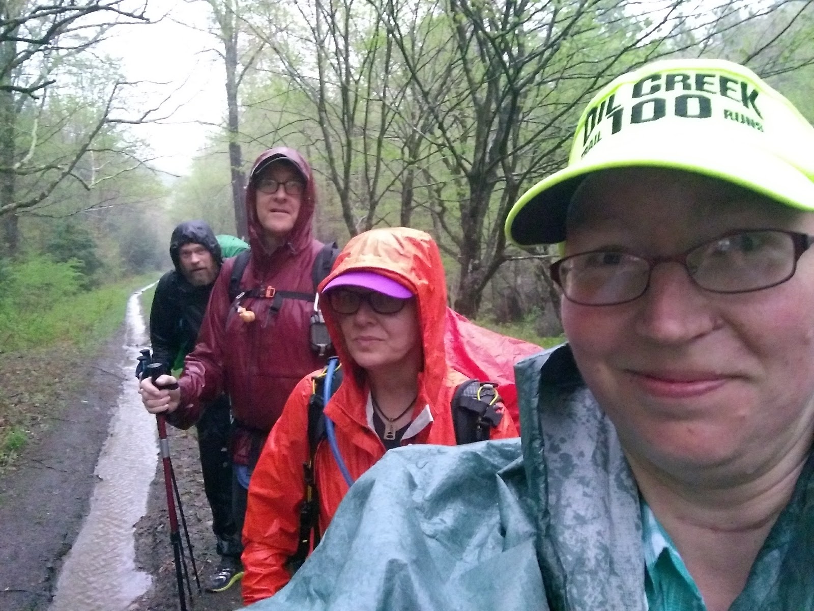
Blurry and rainy

Now, I was enjoying the hike, and the storm wasn't bothering me that much, but somewhere between dinner and finding camp, on the hike through the mud and the slowly dimming daylight, I had an internal anxiety attack.  Or a panic attack.  Or severe wave of home-sickness.  I'm not sure what triggered it.  Maybe it was the rain.  Maybe I missed my kid, or my dogs, or my bed.  Maybe it was the stress of the past six months finally unbottling in unfettered nature.  Maybe it was the isolation, the total disconnect from almost everything I knew, but anyway, my throat closed and I had a couple of tears and for a few moments, I wondered if I could find someone to drive me from the middle of the Suquehannock State Forest back to my house.  What if something had happened to my son, or the dogs?  Or my house?  For a couple minutes, the panic made my throat close up, made my eyes water, and made me think of any excuse I could to get back home.  And I let it, for just a few minutes, take over me.  

Then I took a deep breath, and realized that I love the woods, I love hiking, and I love being with my friends.  I'm not afraid of the dark, and what would I do if anything had happened?  I would deal with whatever happened when I got home.  I let go of the control that I never really had in the first place, and trusted that everything would be ok, or not, and that letting fear and panic ruin my trip, and maybe ruin it for my friends if I all of a sudden found that I needed to get out of the woods, what kind of person would I be?  Not the person I have been for the past few years.  And that was it.  I was ok.  I was still a little nervous a bear would eat my food or rip my tent. And I was a little worried about things at home, but once I accepted that worrying wouldn't change anything, I overcame that anxiety and sadness, and the moment of panic was over.

Ended the day on a soggy double track before we found a camp with the sound of spring peepers surrounding us.


Elevation profile for the first day of hiking.

So we found this little campground with streams and a boggy area around it, and it was surrounded by spring peepers, and that lulled me to sleep in my tent, cozy under a sprinkle of rain on my tent-fly, with a gentle sound of a rain swollen stream.  And I slept really well.

Part One, if you missed it. Part TwoPart Three, Part Four.